
I’ve always loved visiting national parks. The opportunity to experience unique landscapes, get out on the trails, and explore different parts of the U.S. is something I keep coming back to. In fact, I try to visit at least one a year. And with more than 60 national parks spread across the country, each one offers something completely different! When spring break rolled around in March, a trip to Death Valley felt like the perfect choice. The timing offered milder temperatures compared to the intense summer heat (or so I thought), making it an ideal season to explore one of the most extreme environments in the United States. For this trip, I spent three days in Death Valley National Park, traveling with my mom. Together, we built an itinerary, and in this blog I’ve broken down our experience into a day-by-day plan.
If you only have one day in Death Valley National Park, Day One highlights the essential “must-do” stops. These are the most popular spots and also the places that truly define the park. For those with more time, Days Two and Three build on that foundation, adding less crowded viewpoints, scenic drives, and a deeper look at the park’s diversity. Whether you’re planning a quick visit or a longer stay, this itinerary is designed to help you make the most of your time in Death Valley.
Know Before You Go

Located in eastern California along the Nevada border, Death Valley National Park is the largest national park in the contiguous United States, spanning more than 3.4 million acres. The park is known for its dramatic elevation changes, from 282 feet below sea level at Badwater Basin to mountain peaks rising over 11,000 feet. Despite its remote feel, Death Valley is relatively easy to access by car, with the most common route (and the way we traveled) being a roughly two-hour drive from Las Vegas. Well-maintained roads connect many of the park’s major viewpoints, making it possible to experience a wide range of landscapes- from salt flats and sand dunes to canyons and volcanic craters- even on a shorter visit.
At the same time, much of Death Valley remains rugged and undeveloped. Some areas of the park-particularly more remote locations like the Racetrack Playa or certain backcountry roads- require high-clearance or four-wheel-drive vehicles to access safely. While we chose to focus on the more accessible highlights, it’s helpful to know that there are additional, more adventurous options for those with the right vehicle and experience.
History of Death Valley National Park
The Death Valley region has a long and complex history, beginning with the Timbisha Shoshone people, who have lived in the area for centuries. Death Valley earned its ominous name during the California Gold Rush in the mid-1800s. A group of pioneers became lost in the valley while trying to reach the goldfields, enduring extreme heat, scarce water, and rough terrain. Although most of the group survived, the valley was so harsh that one member reportedly said, “Goodbye, Death Valley,”. And the name stuck! In the late 1800s, mining operations, particularly borax extraction, brought increased attention to the valley and played a significant role in its early development. Most commercial mining in Death Valley ended by the mid-20th century, leaving the landscape largely preserved. The area was designated a national monument in 1933 and later became a national park in 1994, protecting its unique landscapes and ecosystems for future generations.

Park Fees, Hours, and Where to Stay
- Death Valley National Park charges a standard vehicle entrance fee of $30 per vehicle, valid for 7 consecutive days. This fee covers all occupants of the vehicle. Annual passes and the America the Beautiful pass ($80 a year) are also accepted.
- The park is open 24 hours a day, 7 days a week, year-round. Visitor centers, exhibits, and facilities have more limited hours, typically from mid-morning to late afternoon.
- Conditions in Death Valley can change quickly, from road closures to extreme weather or trail warnings. Before your visit, it’s a good idea to check the official National Park Service website for up-to-date information. It will tell visitors about closures, alerts, and safety notices to plan your trip accordingly.
- Make sure to fill up before you head in! Gas stations are limited; Furnace Creek, Stovepipe Wells, and Panamint Springs are the main fueling points. (And it’s more expensive in the park- we filled up in Beatty before heading into the park everyday).
- Cell service is extremely limited in the park. Make sure to download maps and plan ahead.
- Death Valley is one of the hottest and driest places in North America, and so water is critical! Plan to carry at least one gallon per person per day, especially if you’re hiking or spending extended time outdoors. Many trailheads and viewpoints don’t have drinking water, so refill whenever you can at visitor centers, lodges, or gas stations.

Where to stay
Furnace Creek is the main hub for accommodations in the park, offering two primary lodging options:
- The Inn at Death Valley. This upscale, historic resort has modern rooms, pool, and full-service restaurant. It is ideal for travelers seeking comfort and a quieter atmosphere.

- The Ranch at Death Valley. A casual, family-friendly lodge with motel-style rooms, cabins, buffet dining, and an on-site general store. It also offers additional amenities including a golf course and a saloon/restaurant. The Ranch is a great stop for refilling water, grabbing snacks, or picking up maps and basic supplies before exploring the park.


While Furnace Creek is the main hub, the park also has other lodging options for those looking for variety or a quieter base:
- Stovepipe Wells Village. Located in the central part of the park near the Mesquite Flat Sand Dunes, Stovepipe Wells offers motel-style rooms, a general store, and a casual café. It’s convenient for exploring sand dunes, canyons, and other central attractions without backtracking.


- Panamint Springs Resort. Situated along Highway 190 near the western edge of the park, Panamint Springs is a small, rustic resort with rooms, cabins, and a campground. It’s a good choice for visitors coming from the western side.

There are also smaller lodges and motels outside the park, including in Beatty, NV, which is where we stayed. It is convenient for travelers looking for a quieter or more budget-friendly base.
Camping at Death Valley NP
Death Valley has several options for tent and RV camping. Popular sites include Furnace Creek Campground (reservation recommended, especially in spring), Texas Springs Campground (near Furnace Creek, first-come-first-served) and Mesquite Spring Campground (closer to Stovepipe Wells, first-come-first-served). Most campgrounds are basic desert-style sites with limited amenities. Water, shade, and facilities are minimal in most locations, so it’s essential to bring plenty of water and plan ahead.
Three day visiting Death Valley National Park

Okay, let’s get into our three days visiting Death Valley National Park. Death Valley is a place of extremes- vast, dramatic, and often surprising. From the lowest point in North America to jagged salt formations and colorful canyon walls, it’s a landscape that feels both immense and intimate at the same time. We wanted three days to explore and created an itinerary that highlighted the park’s most iconic sites without feeling rushed. If you only have limited time to explore, our first day is THE PERFECT itinerary. We started early and went all day long. We got an early start because, even though we were visiting in March, it was going to be record-breaking heat!
Temperatures in Death Valley National Park.
Death Valley experiences some of the most extreme temperatures in North America. Remember it’s the hottest place on earth! Summers here are no joke. Daytime highs often climb past 115–120°F (46–49°C). Even the nights don’t offer much relief, sometimes staying above 90°F (32°C). Spring and fall are easily the sweet spot. Days are warm but manageable, usually between 70–90°F (21–32°C). Nights cool off just enough to feel comfortable. Winter is surprisingly pleasant. Daytime temperatures sit in the 60s–70s°F (15–24°C). Nights can get chilly, dipping into the 30s°F (0–5°C). No matter when you visit, make a stop at the Furnace Creek Visitor Center and don’t skip the classic thermometer photo- it’s basically a rite of passage.

As you can see from the pic, the temperature reached about 100 every day we were there in March. However, that is not the norm. But at least I can say that I have experienced Death Valley in an authentic way, right?
Day One in Death Valley National Park: The perfect one-day itinerary

We chose to stay in Beatty, a quiet town just outside the park. It provided easy access to the park each morning. It also had affordable lodging, and a relaxing place to unwind after long days of sightseeing. However, Beatty was lacking in grocery stores, so make sure to stop in Las Vegas to stock up on supplies. Our mornings began with the drive into Death Valley via Daylight Pass, which takes about 45–50 minutes. The road itself is part of the experience, gradually opening up to reveal sweeping desert valleys and mountain ranges in the distance.
Sunrise at Zabriskie Point
We arrived at Zabriskie Point just before sunrise, and the view was stunning. Already a small crowd had gathered, and the short, paved walk made it easily accessible. The sun began to rise, but facing away from the sun and looking out at the overlook was even better. From that vantage point the badlands glowed with gold and amber tones. The landscape here was stunning, with colorful ridges and folds formed from ancient lakebed sediments.


Zabriskie Point has such an amazing panoramic view. It was an incredible way to start our time in Death Valley national park.
Zabriskie Point also serves as a trailhead for longer hikes. Trails from here can connect to Golden Canyon for a 4–5 mile point-to-point route. Or there is an option to loop into the more strenuous Badlands Loop. From the viewpoint, we could watch hikers winding their way below, which added a sense of scale to the landscape. For us, we chose to enjoy the view and then drive to Golden Canyon separately.

Golden Canyon to Red Cathedral
Next up we headed up Badwater Road (just a short drive away) to what is probably the most popular hike in the park- Golden Canyon. Golden Canyon offered a close-up experience of Death Valley’s unique geology. From the start of our hike, the trail winds through canyon walls in shades of gold, yellow, and soft brown, carved over thousands of years by erosion and water flow. There were also lots of slot canyons for those in the mood to explore off the beaten path.


About 1.5 miles in, my mom decided she needed a break. I continued on, shortly finding a short spur that leads to Red Cathedral. This striking red rock formation rises dramatically against the canyon walls.

Like many of the hikes that I encountered in Death Valley, the climb involved lots of lose gravel. Perhaps not accessible for everyone, and I was glad I had my hiking shoes. But at the top I was awarded with incredible views.


Even at a leisurely pace, the hike felt immersive. The contrast between the golden canyon and the deep red cliffs made it one of the most memorable parts of our day.
Devil’s Golf Course
After our hike, we go in the car and continued up Badwater Road, shortly coming to Devil’s Golf Course. This presented a completely different landscape from where we just hiked. Don’t be fooled by the name- it’s not a golf course! Instead it’s a chaotic salt landscape. Jagged, sharp pinnacles of salt rise from the ground, formed by repeated evaporation, uplift, and wind erosion. The name is because, famously, “only the devil could play golf” here. Even just viewing it from the parking lot, the landscape feels dramatic and otherworldly. It was just incredible.


Badwater Basin
Next, we visited Badwater Basin, the lowest point in North America at 282 feet below sea level. Stepping out onto the salt flats feels truly otherworldly. We parked and began a walk that stretched over half a mile across the dazzling white crust. It looked like we were walking on a beach towards the ocean, but it’s salt! And the sun reflected off the salt so intensely that it was blinding at times, making sunglasses and a hat essential.

Because it is a basin, water that flows in from surrounding mountains has no outlet and evaporates quickly under the intense desert sun. Over time, this process leaves behind vast salt flats, creating the iconic white crust that stretches for miles. It’s also fascinating to think that this area was once part of a prehistoric lake system, now reduced to stark white flats under the desert sun.


Driving further down Badwater Road, we pulled off at the edge of the salt flats. I wanted to explore more and stepped out onto what felt like a desert “beach.” A thin layer of water shimmered across the crusty salt, and as I approached it, my feet began to sink into the salty sand, my shoes quickly coated with the mineral crust. I kicked them off and waded a little further, and then something incredible happened- the salt beneath my feet became so thick and buoyant that I no longer sank! It almost felt like walking on water. It was a surreal experience that perfectly captured the otherworldly nature of Death Valley. The salt flats seem to stretch endlessly in all directions, forming geometric patterns underfoot. It was one of the coolest, most unforgettable moments of the trip.


Artist’s Drive and Artist’s Palette
As we headed back down Badwater Road toward Furnace Creek, we made time for Artist’s Drive, a scenic loop that ended up being one of the most visually unique parts of the day. This nine-mile, one-way drive winds along an alluvial fan at the base of the Black Mountains. In case I’m not alone (because I had to look it up), an alluvial fan is a broad slope formed over time as water carries sediment down from the mountains and spreads it across the valley floor.

Not far into the drive, we pulled over at one of the early viewpoints. There I climbed a small hill to get a better perspective. From the top, the shape of the alluvial fan became much more visible- wide, gently sloping, and fanning outward from the mountains. It gave a clearer sense of how water, even in such a dry place, has played a major role in shaping the landscape over time.


As the drive continues, the hills become more streaked with soft pinks, greens, purples, yellows, and reds, created by the oxidation of different metals in the volcanic rock. Iron produces reds and oranges, copper contributes greens, and other minerals create subtle variations throughout the terrain. The result is a layered, almost chaotic blend of color that feels completely different from anywhere else in the park.


The highlight is Artist’s Palette, where you can pull over and walk a short distance into the hills for a closer look. The colors are even more vivid in person, especially as the light begins to shift later in the day. It’s a quick stop, but one that leaves a lasting impression.


Death Valley National Park Superbloom
While Death Valley National Park is best known for its stark, desert landscapes, there are rare moments when it transforms into something completely unexpected. During certain years, the park experiences a “super bloom,” when well-timed rainfall triggers a widespread burst of wildflowers across the valley.

We were lucky enough experience a superbloom during our three days in Death Valley National Park, and it added an entirely different dimension to the trip. As we explored, we came across several sections where wildflowers had taken over the desert floor- bright yellows, soft purples, and pops of pink breaking up the otherwise muted landscape. One of the places were we saw a lot of the yellow flowers was right along Badwater Road.


The Furnace Creek Visitor Center and park rangers had helpful signs and up-to-date information on where to find the best blooms, which made it easy to incorporate them into our route. We also noticed that many visitors were there specifically for the super bloom, a reminder of how rare and special this phenomenon is. Super blooms don’t happen every year, and even in good years, timing and location can vary. Experiencing it firsthand made the park feel even more special. It is proof that even in one of the driest places on Earth, life can appear in the most unexpected and beautiful ways.
Furnace Creek Visitor Center
By mid-afternoon, after exploring the salt flats and desert canyons, we returned to the Furnace Creek area for a break. The visitor center provides helpful exhibits on geology, wildlife, and climate, along with essential amenities like restrooms and water refill stations. Death Valley operates a little differently than many national parks- there aren’t traditional entrance stations where you pay on your way in. Instead, you’ll need to pay the entrance fee at a visitor center or one of the park’s fee kiosks. Be sure to display your pass or receipt in your vehicle, as rangers do check. You’ll also need proof of payment to pick up an official park map, so it’s worth taking care of that early in your visit.

And of course, you can get the obligatory stamp for your National Park passport books, as well as buy any souvenirs you want.This is also where you can take your selfie by the thermometer. In all of Death Valley national park, this is the only visitor center, but it is conveniently located by lots of the tops sites to see in Death Valley.
Twenty Mule Team Canyon
Later our first day, we took a scenic 2.7-mile drive through Twenty Mule Team Canyon, located just past Zabriskie Point off Highway 190. Despite this one-way road being dirt it was still manageable in a standard car. The winding hills, pale and softly contoured, almost looked like massive piles of sculpted earth. Shaped by time and erosion, the landscape has a quiet, otherworldly quality. Knowing this route was once used to transport borax adds an extra layer of historical context. After several stops on foot earlier in the day, this drive offered a welcome shift to a more relaxed but equally visually striking experience.

Dante’s View
We concluded our first day in Death Valley national park at Dante’s View, located just a short drive off the main road near Twenty Mule Team Canyon. Perched at 5,475 feet, Dante’s View offers a sweeping perspective over the entire valley. From this vantage point, Badwater Basin is visible far below, with the Panamint Mountains stretching across the horizon.

The drive up to the peak took about 20 minutes, and the higher elevation brought noticeably cooler air. It was a welcome change after a full day in the desert heat. Even without staying for sunset, the views were incredible. It’s worth noting that this is a popular spot to end the day, so if you do plan to visit at sunset, it’s best to arrive early, as the parking lot is relatively small and fills up quickly.


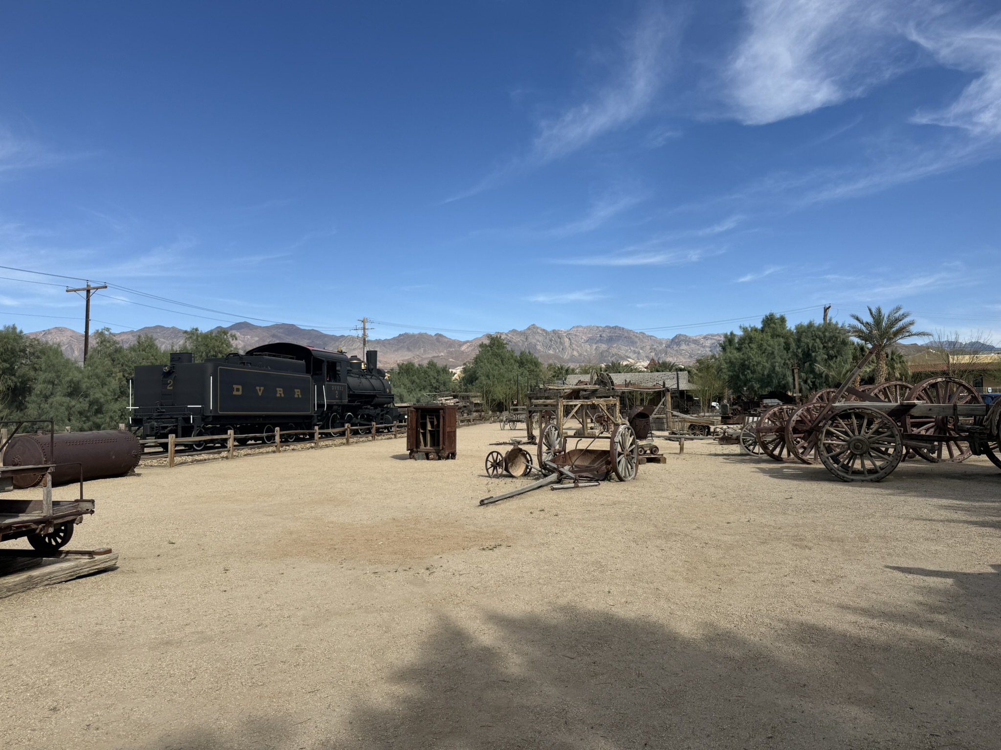
The Borax Museum at Furnace Creek
We headed back the Furnace Creek area to make our dinner reservations at one of the lodges- The Ranch at Death Valley. The Ranch also has a small but fascinating stop: the Borax Museum. Housed in one of the oldest buildings in Death Valley (originally built in the 1880s), the structure itself was once used as an office and bunkhouse for miners before being relocated to Furnace Creek.


Inside, the museum tells the story of borax mining in the region, with displays of old tools, photographs, mineral samples, and artifacts from the early days of Death Valley. Outside, you can see larger pieces of equipment, including wagons used by the famous twenty-mule teams that transported borax across the desert. It’s a quick stop, but a really worthwhile one.


Dining at the Ranch at Death Valley
So finally it was dinner timer, and we had worked up an appetite! Earlier in the day, we had breakfast at The Ranch’s buffet, which was a perfect way to start after sunrise. We also browsed the general store, picking up snacks and souvenirs while resting before continuing the day. We returned to The Ranch for dinner at The Last Kind Words Saloon. It offered a relaxed, Western-inspired atmosphere and hearty food- just what we needed after a long, sun-filled day. Be sure to make reservations in advance, the place booked up! It was the perfect way to unwind and reflect on the highlights before heading back to our hotel in Beatty.


Using the GuideAlong App
I would be remiss to not mention one thing that really enhanced our trip- using the GuideAlong app. Guidealong is a GPS-based audio tour that plays automatically as you drive, sharing information about the landscape, history, and nearby points of interest in real time. As you move through the park, it essentially acts like a personal tour guide, pointing out stops you might otherwise miss and giving context to what you’re seeing.

I’ve used GuideAlong in several national parks, and we found it especially helpful in a place like Death Valley, where so much of the experience is tied to understanding the geology and history. It also helped us stay oriented and plan our stops more intentionally. It’s an easy addition that can make a big difference, especially if you enjoy learning as you explore. Download it before any of your roadtrips for about $10-20
Day Two in Death Valley National Park
After a full first day of three in Death Valley National Park, which included iconic viewpoints and most of the top-visited sites, our second day in Death Valley focused on some of the park’s more varied- and often less crowded- landscapes. Once again, we set out from Beatty, building a route that balanced short walks with longer scenic stops.
Natural Bridge Trail
We started the morning not quite as early as our first day. We did want to get in an early hike, so we headed back down Badwater Basin road that we had driven the day previous to check out a spot we had missed- Natural Bridge Trail. The hike to the Natural Bridge was relatively short, though slightly uphill through a gravel wash so it was a bit tricky. The wide, gravel-filled canyon with gently rising walls really give a sense of the scale and geology of the area.

After less than a half mile down the trail you arrive to a naturally formed rock arch. Natural Bridge is a striking rock formation carved over time by water flowing through the canyon, eventually eroding a hole through the rock and leaving behind a natural arch. Suspended above the canyon floor, the bridge is surprisingly large when seen up close and offers a great example of how powerful flash floods can be in shaping the desert landscape.


However, just beyond the bridge is another highlight- a dry waterfall. Its visible by the smooth, vertical rock. Even without flowing water, the shape of the rock tells the story of past erosion. It’s really something to see.


After passing the dry waterfall, the canyon begins to narrow and the terrain becomes rockier and less defined. Eventually, the trail is blocked by a cluster of large, smooth boulders, worn down by years of water flow. While it’s possible to scramble over them, this is where many hikers choose to turn around.


To reach that end point, it is only about 3/4 of a mile, and then back to the parking lot is all downhill. It’s a compact hike that offers a mix of geological features without requiring a major time or energy commitment.
Harmony Borax Works
Our next stop, just north of Furnace Creek, was Harmony Borax Works, which offers a glimpse into Death Valley’s mining history. In the late 1800s, this site served as a major processing plant for borax. Just like we had seen the previous day at the Borax museum, Borax is a mineral used in cleaning products and industrial applications. The remains of the operation are still visible today at Harmony Borax Works, including sections of the original structures and equipment once used to refine and transport the material.


Today, it’s an easy and quick stop, with a short walking path and plenty of interpretive signs explaining how borax was extracted and hauled across the desert by the famous twenty-mule teams. While it doesn’t take long to explore, it adds valuable historical context to the landscape- especially when paired with places like Twenty Mule Team Canyon that we drove on day one, where those transport routes once ran.
Mesquite Flat Sand Dunes
Next stop on day two of Death Valley national park was one of the most iconic landscapes there- the Mesquite Flat Sand Dunes. It was pretty surreal to see these sand dunes rising up right from the valley floor. They don’t actually cover a huge area- only about a few square miles. However, they feel much larger when you’re standing among them. Set against the surrounding mountains and flat desert basin, they look completely different from the rest of the scenery.

The dunes form here because sand is carried into the valley by wind and erosion from the surrounding mountains, then are by the shape of the landscape and consistent wind patterns. Over time, the sand accumulates into these rolling formations, creating one of the few true dune fields in the park. There’s no set path in the dune, which makes it easy to explore at your own pace. We simply wandered out into the sand and took it all in.


Along the way, we were excited to notice tracks left behind by desert wildlife. We saw the distinctive prints of kangaroo rats- small nocturnal rodents adapted to survive without drinking water. We also noticed the winding trails of sidewinder rattlesnakes, which move sideways across the sand. There were also signs of kit foxes- small desert foxes with large ears that help them regulate body temperature and hunt at night. Later, I spotted a lizard perched on a branch, so well camouflaged it nearly blended into the landscape.


We walked just far enough to feel surrounded by the dunes, which was more than enough to appreciate their scale. The shifting sand, wind patterns, and quiet stillness made this area feel especially peaceful. It was great experience.
Stovepipe Wells Village
By midday, we made our way to Stovepipe Wells Village for a break, which ended up being the perfect place to stop for lunch. Located in the central part of Death Valley near the Mesquite Flat Sand Dunes, it’s a convenient hub for food, fuel, and a bit of rest in the middle of a long day of exploring.
Stovepipe Wells has lodging, a saloon and a restaurant, which is where we ate. The Toll Road Restaurant offered a casual atmosphere and a welcome chance to sit down and cool off. Afterward, we spent some time in the general store, picking up a few souvenirs. While it’s not large, it has everything you might need to refuel- both yourself and your supplies- before heading back out into the park.

Ubehebe Crater
Ubehebe Crater was one of the most impressive stops of our trip. Formed by a volcanic explosion thousands of years ago, this massive crater measures over half a mile across and plunges several hundred feet deep. The name “Ubehebe” comes from a local Paiute word, reportedly meaning “big basket,” which feels fitting given the crater’s enormous bowl-like shape.

We chose to walk the full 1.5-mile rim loop, which offers constantly shifting perspectives of the crater and the surrounding desert. The trail includes some uphill, uneven and loose sections, but moving carefully made it manageable. The rim alone provides awe-inspiring views, and the high vantage point makes it a great spot to catch the sunrise or sunset, when the desert light would cast dramatic shadows across the volcanic formations. We also saw lots of flowers blooming, which added even more to the beautiful views.


Along the way, I took a short spur trail that led closer to Little Hebe Crater, a smaller volcanic formation just north of Ubehebe. From this viewpoint, it was fascinating to see how multiple craters punctuate the landscape, showing that Death Valley’s volcanic past was more than just a single explosion.

For those interested in a closer look, there is a steeper path that descends into Ubehebe Crater itself, though we didn’t take it.

The crater is located in the northern section of Death Valley, and from Stovepipe Wells Village, it’s about a 40-minute drive north along the mostly paved Ubehebe Crater Road / Route 374. Unlike most other trailheads in the park, there are no restroom facilities at the crater itself, so it’s important to stop at the ranger station or other facilities along the way before arriving.
A Note on Scotty’s Castle
Ubehebe Crater is also located near the road that leads to the famous Scotty’s Castle, a striking historic mansion built in the 1920s with a mix of Spanish Colonial Revival and Mediterranean styles. The castle, famously backed by the colorful gold-mining conman Walter “Death Valley Scotty” Scott, has been closed to the public since a severe flash flood in 2015 damaged the property. The access road was also damaged and is closed to everyone. While limited guided tours by reservation are now offered during select months, full access remains restricted as restoration continues.


Day Two Reflections
Just like the first day, day two of three in Death Valley National Park felt varied. We moved from canyons to dunes to volcanic landscapes. It did involve a bit more driving, but each stop offered something distinctly different. And once again, pacing made all the difference. By mixing short walks with longer scenic stops and building in a lunch break, the day remained enjoyable without feeling overwhelming (or without us dying from heatstroke).
Day Three in Death Valley National Park
Our third (and final) day in Death Valley National Park felt a little different, but in the best way. These were the add-ons, the places that fit beautifully into your itinerary if you have extra time. We left Beatty in the morning, and had a couple stops planned, with the intention of ending in Lone Pine. However, we got a suggestion during the day that took us even more off the beaten path. We had a really great time soaking in the quieter corners of the park, and these are great places to stop if you have more time in Death Valley.
Mosaic Canyon
Mosaic Canyon was easily the highlight of our final day- and one of the most unique hikes we experienced in the park. I would actually consider this a must-do (if was our favorite hike), but it is a bit further from the other must-dos.
Located in the central section of Death Valley near Stovepipe Wells, you have to drive along a gravel road to access the trailhead. It’s manageable in a standard car if you take it slow. What makes this hike so special is how flexible it is. Most people hike about 1–2 miles round trip, and usually takes between 1.5 and 3 hours depending on how far you go and how often you stop. The beginning is relatively easy, following a gravel wash that gradually narrows as the canyon walls begin to rise around you.


Geologically, this canyon is fascinating because of the contrast between two main types of rock you’ll see along the way: smooth marble and rough, darker dolomite. The marble is what gives Mosaic Canyon its signature look- polished, almost silky walls that have been sculpted by flash floods over thousands of years. In contrast, the dolomite is much more jagged and textured, often appearing darker and more rugged. The interplay between these two is actually what gives the canyon its name, like a natural mosaic of different stone patterns and surfaces. It’s so interesting to see, usually with one type of rock flanking one side of the hike and the other on the opposite side. But sometimes you see them come together, like as seen in the bottom right photo.


Hiking Mosaic Canyon

Before too long into the hike the terrain changes, and that’s where the adventure really begins. The canyon is known for its smooth, polished marble walls, shaped over thousands of years by rushing water. However, as you move deeper in, you’ll encounter dryfalls and rock ledges that require some scrambling. Some of these are fun and fairly manageable, but others can be more challenging, especially if you’re not used to climbing over uneven rock.
It’s also worth noting that this isn’t a heavily trafficked trail, so the route isn’t always obvious. Instead of a clearly defined path, you’ll look for the rocks patterned into arrows on the ground that guide you through the canyon. Or piles of rocks that act as a border, almost like saying “don’t go this way!”.


One thing I really appreciated, especially traveling with my mom, was that this hike was beautiful no matter how far you went. My mom did a mile, and I continued on over some scrambles. I saw plenty of people turn around once the scrambling started to get more difficult. At the far end of the hike in Mosaic Canyon, hikers eventually reach a series of larger dryfalls, including one main, taller drop-off that acts as a natural turnaround point for most people.
The end of Mosaic Canyon- dry waterfalls


These dryfalls are essentially steep rock ledges carved by past flash floods. Early on, they’re small and fun to scramble over, but toward the end, they become much more difficult, often requiring more technical climbing or careful maneuvering. It can be challenging to get up (and especially back down) without experience or the right footwear. So take your time and caution.


Hiking this together ended up being one of my favorite experiences. My mom and I were able to explore at our own pace, taking in the quiet, and just enjoying being in such an incredible place.
Charcoal Kilns
Our next stop was a stop that I didn’t think we were going to be able to access- the Charcoal Kilns. After talking to an employee at Stovepipe Wells who assured us our car would be fine, we decided to make the drive, and I’m so glad we did. Charcoal Kilns are tucked high in the Panamint Mountains on the western side of the park, and getting there is part of the experience.
It was about 1.5–2 hours from Mosaic Canyon and the road climbs steadily into the mountains, with winding turns and incredible views. We had to drive in and out the same way due to a road closure (damage from major flash floods in recent years), but honestly, that just meant we got to enjoy the scenery twice. Along the drive, there are several scenic pull-offs where you can look back across Death Valley, it’s one of those places where the scale of the park really hits you.

The kilns themselves are fascinating. These perfectly preserved, beehive-shaped ovens at Charcoal Kilns were built in the 1870s to produce charcoal for nearby smelting operations. Inside, they’re surprisingly cool and echo-filled, a stark contrast to the desert heat below. You can still smell the charcoal inside.

This area of the park, high in the Panamint Mountains on the western side, was chosen very intentionally for the kilns. Unlike the valley floor, this higher elevation had pinyon pine and juniper forests, which provided the wood needed to make charcoal. The cooler temperatures also made it possible for workers to live and operate here more comfortably. The charcoal produced in these kilns was then transported to smelters to help process ore from nearby mines, tying this quiet mountain setting directly into the region’s mining boom.


Wildrose Peak
Today, the area feels peaceful and removed, and it’s also a starting point for a few lesser-known hikes. One of the most notable is the trail to Wildrose Peak, a challenging hike that climbs to one of the highest points in the park. There’s also the trail to Thorndike Campground, which can be explored as a shorter out-and-back or used as part of a longer trek deeper into the mountains.

Wild Burros
On the way back down from the kilns we spotted a group of wild burros crossing the road. These burros are actually descendants of the animals brought by miners in the 1800s. When mining operations shut down, many were released or escaped, and over time they adapted to survive in the harsh desert environment. Seeing them wandering through the mountains felt like a living connection to the park’s history and we were ecstatic to see them.


Aguereberry Camp
Speaking of mining- on the way to the Charcoal Kilns (and thanks to the GuideAlong app) we took a gravel road about two miles to detour and see some historic sites. Aguereberry Camp was home to a prospector (Pete Aguereberry) who spent decades trying to strike it rich. A discovery in 1905 started a boom and the tent town of Harrisburg popped up. Aguereberry outlasted them all and his buildings still stand (barely) today.


It was both fascinating and a little eerie to wander through the buildings. As I walked farther down a gravel path, I came across an abandoned mine shaft, along with rusted metal chutes that once transported ore. Nearby, an old, abandoned car sat quietly, adding to the sense that this place had been frozen in time.


Eureka Mine
I continued walking, and the discoveries just kept coming. I came across adits- the horizontal entrances into the mine- and then the main mine itself. The rusted train tracks lead out of it, showing how ore was once transported. It was just thrilling to see.

Along with other metal remnants from the mining days was the cashier mill. That was used to process the ore extracted from the mine, separating valuable minerals from the rock. The remains of the Eureka Mine give you a glimpse into the industrial side of that mining dream. Weathered equipment and the crumbling structures gave a tangible sense of how difficult life must have been in this harsh desert environment.


The gravel road we came in on does have vehicle access to the Eureka Mine, or you can follow a walking path from Aguereberry Camp that leads right up to the site. Either way, you get a real sense of the scale and effort involved in the mining operations. It was a completely unexpected stop but one that was really thrilling for me.
Panamint Springs
By that point in the day, we had seen most of what Death Valley had to offer, and we began our drive toward Lone Pine at the opposite end of the park. Along the way, we passed by Panamint Springs. Located on the far western edge of Death Valley, this small outpost is one of the few places to grab food, a cold drink, or fuel. We stopped for ice cream, a really nice treat after a full morning of exploring.

Father Crowley Overlook
A short drive from Panamint Springs brought us to Father Crowley Overlook. This overlook sits above Rainbow Canyon on the western edge of the park and offers sweeping, dramatic views. Named after a local priest who advocated for preserving the area, it’s one of the best vantage points in Death Valley. The colors, the depth of the canyon, and the sheer openness of the landscape made it a perfect final stop.
Drive to Lone Pine
We ended the day by heading to Lone Pine, about an hour from the overlook. As the desert slowly gave way to the towering Sierra Nevada mountains, it felt like stepping into a completely different world. After a day of winding roads, hidden history, and unexpected wildlife sightings, it was the perfect place to land for the night. We spend the next few days visiting Lone Pine, where the Alabama Hills sit on the base of Mount Whitney. It was stunning! More about Lone Pine in a blogpost to come.

Other places to visit while in Death Valley National Park
We took full advantage during our three days in Death Valley National Park and visited a few other great sites. Nestled just outside the northeastern entrance to Death Valley National Park, Beatty is a small, quiet town that made a surprisingly convenient home base for exploring the park. With a population of just a few hundred people, Beatty feels like a classic desert stop: wide open skies, dusty streets, and a welcoming, laid-back atmosphere. Despite its small size, the town has several motels, restaurants, and gas stations. It was lacking in grocery stores, so make sure to stock up on supplies before you arrive.
Rhyolite Ghost Town
Beatty is rich in history. Once a thriving mining town during the early 20th century, you can still catch glimpses of its past in the old buildings and abandoned structures scattered around the outskirts. For history buffs, the nearby Rhyolite Ghost Town offers a dramatic glimpse into the mining boom that once fueled this area.

The town sprang up almost overnight in 1904 when gold was discovered nearby. At its peak, Rhyolite was surprisingly built-up for such a short-lived place. There were banks, a stock exchange, a school, an opera house, even electric lights and running water. People clearly thought it was going to last. But the gold started running out, the 1907 financial panic hit, and within just a few years the population vanished. By around 1916, it was essentially abandoned.


Today all that is left is a scattering of really photogenic ruins. The most striking is the Cook Bank Building, with its three-story stone walls still standing. There’s also the remains of the train depot, a jail, and Tom Kelly’s Bottle House.
Tom Kelly’s Bottle House
The Bottle House, built almost entirely from glass bottles, is a fascinating and photogenic example of creative desert architecture. Walking around it, you can admire how everyday bottles were transformed into walls and windows. The house has an almost magical glow in the sunlight. I was completely charmed by it.


Goldwell Open Air Museum
Just furthur down the road from Rhyolite Ghost Town is the Goldwell Open Air Museum. Set right in the desert against the backdrop of the Bullfrog Hills, it’s a small outdoor sculpture park where art and landscape kind of blur together.

Probably the most iconic piece is “The Last Supper”. This row of life-sized, ghostly figures draped in white, is modeled after da Vinci’s painting. They’re made from plaster over chicken wire, and seeing them out in the open desert is equal parts eerie and fascinating. Another standout is “Ghost Rider,” a skeletal figure on a bicycle, which leans into that same haunting, abandoned-desert vibe.


The museum started in the 1980s as an artist-driven project, and it’s still evolving. There’s even a small indoor gallery nearby when it’s open. But the real draw is how informal it all feels. There are no walls, no real boundaries- just art sitting out in the desert, exposed to the elements. It’s free to visit, easy to walk through in 20–30 minutes, and pairs perfectly with exploring Rhyolite.
Concluding three days in Death Valley National Park
Three days exploring Death Valley National Park was even better than I ever imagined. Every corner of the park offered something different- geology, history, and sheer natural beauty. Death Valley may be known for its extremes, but it’s also a place that rewards curiosity, patience, and a willingness to wander a little off the beaten path. Traveling with my mom made it even more special. Three days here gave us a perfect mix of adventure, reflection, and awe, a trip I’ll treasure for years to come. Have you been to Death Valley National Park? Do you have a suggestions for my next adventure? I’d love to hear from you! Thanks for checking out my blog, catch you soon!
-Catching Katie


Leave a Reply